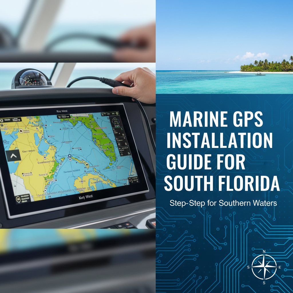
Your marine GPS system is arguably the most critical piece of electronics on your vessel, yet improper installation can turn this essential safety tool into a source of frustration or even danger. When navigating the challenging waters from St. Lucie Inlet to the Gulf Stream and across to the Bahamas, a professionally installed marine navigation system isn’t just about convenience—it’s about getting your crew home safely.
The marine GPS installation process involves far more than mounting a display and connecting power. Professional installers must account for antenna placement, NMEA network integration, power supply requirements, interference mitigation, and South Florida’s uniquely challenging saltwater environment. Understanding these factors helps boat owners make informed decisions about their navigation system investments.
Understanding Modern Marine GPS System Components
Today’s marine navigation systems consist of multiple integrated components working together through standardized communication protocols. A typical professional marine GPS installation includes the chart plotter display, GPS antenna, power connections, and integration with existing vessel systems through NMEA 2000 or NMEA 0183 networks.
The GPS antenna receives signals from multiple satellite constellations—typically GPS, GLONASS, Galileo, and increasingly BeiDou—to provide position accuracy within three meters under normal conditions. High-precision systems using WAAS (Wide Area Augmentation System) or SBAS corrections can achieve sub-meter accuracy, critical for navigating tight inlets like St. Lucie or Boynton Beach during challenging sea conditions.
Modern chart plotters have evolved into multifunction displays that integrate GPS navigation with radar, sonar, AIS, weather data, and vessel monitoring systems. This integration requires careful planning during installation to ensure all systems communicate properly and share data effectively across the marine electronics network.
Critical Antenna Placement Considerations
GPS antenna location dramatically impacts system performance. The antenna requires clear sky view with minimal obstructions to receive signals from satellites across the horizon. On South Florida vessels, common obstructions include T-tops, radar arches, hardtops, and towers—all popular accessories that can create signal blockage zones.
Professional marine electronics installers evaluate the entire vessel structure to identify optimal antenna placement. The antenna should be mounted as high as practical while maintaining clear line-of-sight to the sky hemisphere. For most center consoles and express cruisers, the ideal location is atop the T-top or hardtop, positioned away from other electronics that might cause interference.
Metal structures near the antenna can cause multipath interference, where GPS signals reflect off surfaces before reaching the antenna, degrading accuracy. Maintaining at least twelve inches of separation from VHF antennas, radar scanners, and satellite communications domes helps prevent both physical obstructions and RF interference that can compromise navigation accuracy when you need it most.
Interference Mitigation Strategies
Marine environments present unique RF interference challenges. Radar systems, VHF radios, satellite phones, and cellular boosters all generate electromagnetic energy that can interfere with GPS reception. Professional yacht GPS installation requires careful frequency coordination and physical separation to prevent these systems from degrading each other’s performance.
Quality marine-grade GPS antennas incorporate filtering and shielding to reject interference, but proper installation remains essential. Cable routing away from high-power RF sources, using properly terminated connections, and maintaining manufacturer-specified separation distances all contribute to reliable system operation.
Power Supply Requirements and Protection
Marine GPS systems require clean, stable power within manufacturer specifications—typically 12 or 24 volts DC depending on vessel electrical systems. Unlike automotive environments, marine installations face voltage fluctuations, electrical noise from bilge pumps and other motors, and the constant threat of saltwater intrusion.
Professional marine navigation system installation includes proper circuit protection with correctly sized breakers or fuses, dedicated power circuits to minimize electrical noise, and marine-grade wiring with tinned copper conductors that resist corrosion. All connections should be sealed with heat-shrink tubing and corrosion-inhibiting compounds to survive South Florida’s aggressive saltwater environment.
Inadequate power protection represents one of the most common installation mistakes. A GPS system sharing a circuit with high-draw equipment may experience voltage drops that cause system resets or erratic behavior. Dedicated circuits with appropriate wire gauge—typically 16 AWG minimum for most installations—ensure consistent performance even when other systems cycle on and off.
NMEA Network Integration
Modern boats utilize NMEA 2000 backbone networks that allow multiple devices to share data using a standardized communication protocol. Your GPS chart plotter needs to connect to this network to share position data with autopilots, radar systems, AIS transceivers, and other navigation equipment while receiving information from depth sounders, wind instruments, and engine monitoring systems.
A professional boat GPS installer South Florida understands proper NMEA 2000 network architecture. The backbone cable requires 120-ohm terminating resistors at each end, T-connectors for device connections, and proper power supply with adequate capacity for all connected devices. Network planning must account for current draw, cable length limitations, and device address assignments to ensure reliable communication.
For vessels with legacy NMEA 0183 equipment, professional installers can integrate older devices using protocol converters or multiplexers, allowing new GPS systems to communicate with existing electronics. This integration preserves your investment in functional equipment while upgrading navigation capabilities with modern chart plotters featuring updated cartography and enhanced features.
Display Mounting and Viewing Optimization
Chart plotter displays must be positioned for optimal viewing from the helm while withstanding South Florida’s intense UV exposure and saltwater spray. Professional marine electronics installers evaluate viewing angles, sun glare conditions, and ergonomic access when determining display locations.
Flush mounting provides the cleanest installation appearance and best weather protection, but requires adequate depth behind the mounting surface for the display chassis and cable connections. Bracket mounting offers more flexibility for installation locations but requires careful selection of marine-grade mounting hardware that won’t corrode or fail in saltwater conditions.
Modern displays feature high-brightness screens designed for daylight viewing, but positioning still matters. Mounting displays perpendicular to primary sun angles—typically on north-facing surfaces in South Florida—minimizes glare issues during most operating conditions. Anti-glare screen protectors and sunshades provide additional viewing enhancement for offshore operations where screen visibility is critical.
Waterproofing and Environmental Protection
South Florida’s marine environment aggressively attacks improperly sealed electronics installations. Professional yacht GPS installation requires attention to IP (Ingress Protection) ratings, proper cable gland installation, and strategic placement to minimize direct water exposure.
Marine GPS displays typically carry IPX6 or IPX7 ratings, indicating resistance to powerful water jets and temporary immersion respectively. However, these ratings assume proper installation with all port covers and cable connections correctly sealed. Behind-the-panel connections represent the most vulnerable points for water intrusion and require careful sealing with marine sealants and proper cable routing that prevents water migration into connection points.
Cable entry points through bulkheads, consoles, and hardtops must be sealed with appropriate marine-grade cable glands or properly bedded through-hull fittings. Simple holes drilled without proper sealing allow water intrusion that causes corrosion, electrical failures, and potential safety hazards. Professional installers use drip loops and strategic cable routing to ensure any water following cables drips away before reaching connection points.
System Testing and Calibration
After physical installation, professional marine navigation system installation includes comprehensive system testing and calibration. This process verifies GPS signal reception quality, confirms NMEA network communication with all connected devices, and validates display functionality under various lighting conditions.
GPS accuracy can be confirmed by comparing displayed position with known reference points—marina slips, navigational aids, or surveyed locations. Heading sensors require calibration through compass swing procedures to compensate for vessel magnetic deviation caused by engines, electronics, and metal structures. Autopilot integration requires additional testing to ensure the GPS provides proper heading and steering guidance.
Professional installers document system configuration, network architecture, and device settings, providing vessel owners with reference information for future troubleshooting or system expansion. This documentation proves invaluable when adding equipment or diagnosing issues that may arise during system operation.
Common Installation Mistakes to Avoid
DIY marine GPS installation often results in problems that compromise system reliability and performance. Antenna placement in obstructed locations, inadequate power supply protection, improper NMEA network termination, and unsealed cable connections represent the most common installation errors encountered when professional installers are called to diagnose system problems.
Using automotive-grade wiring and connections in marine applications invites premature failure. Standard copper wire corrodes rapidly in saltwater environments, automotive crimp connectors lack proper sealing, and incorrect wire gauge causes voltage drops that affect system operation. These shortcuts might save money initially but lead to expensive repairs and potential safety issues when navigation systems fail during critical operations.
Improper cable routing that allows standing water, excessive cable length creating signal degradation, and failure to secure cables properly leading to chafe damage all represent preventable problems when installations follow professional standards and best practices developed through NMEA certification programs and manufacturer training.
Choosing Professional Installation Services
Professional marine electronics installers bring factory training, NMEA certification, and extensive experience with specific equipment and vessel types to every installation. This expertise ensures your navigation system functions reliably when you’re running offshore to the Bahamas or navigating South Florida’s busy waterways during challenging conditions.
When evaluating installation services, consider the installer’s certifications, experience with your specific vessel type and electronics brands, understanding of marine electrical systems, and commitment to following manufacturer installation guidelines. Quality installers provide warranties on their work, maintain insurance coverage, and stand behind their installations with ongoing support.
The investment in professional marine GPS installation pays dividends through reliable system operation, proper integration with existing electronics, and peace of mind knowing your navigation systems were installed correctly. When your safety and vessel navigation depend on these systems, professional installation isn’t an expense—it’s essential insurance.
Frequently Asked Questions
How long does professional marine GPS installation take?
Installation timeframes vary based on system complexity and vessel configuration. A basic single-display GPS installation typically requires four to six hours, while complex multifunction display installations with full NMEA 2000 integration, multiple displays, and system upgrades may require several days. Professional installers provide time estimates after evaluating your specific vessel and equipment requirements.
Can I install marine GPS equipment myself?
While technically possible, DIY installation risks improper antenna placement, inadequate waterproofing, incorrect NMEA network configuration, and electrical problems that compromise system reliability. Professional installation ensures proper integration, optimal performance, and maintained equipment warranties that often require certified installer involvement.
What’s the difference between marine and automotive GPS?
Marine GPS systems feature waterproof construction with appropriate IP ratings, chartplotter software designed for nautical navigation, NMEA network integration capabilities, and marine-specific features including tide data, current information, and depth integration. Automotive GPS units lack these essential marine capabilities and environmental protection requirements.
How often should marine GPS systems be updated?
Chart updates should be performed annually at minimum, with many boaters updating quarterly or using subscription services for continuous updates. Navigation aids, depths, marina facilities, and coastal features change regularly, making current charts essential for safe navigation. Software updates addressing functionality and security should be installed when manufacturers release them.
Do I need multiple GPS displays on my boat?
Multiple displays provide redundancy for offshore operations and allow simultaneous viewing of different chart scales or information screens. Vessels operating in challenging environments or making extended offshore passages benefit from backup navigation capability if the primary display fails. Many experienced Bahamas cruisers install multiple independent GPS systems for this critical redundancy.
Trust Your Navigation to Experienced Professionals
Your vessel’s navigation system represents a critical safety investment deserving professional installation that ensures reliable performance when you need it most. Marine Electronics Installer brings NMEA-certified expertise and factory training to every marine GPS installation, providing South Florida boat owners with properly integrated navigation systems built to withstand our challenging marine environment.
Whether you’re upgrading to the latest multifunction display, adding chart plotter capability to a new vessel, or integrating GPS with existing marine electronics, professional installation ensures optimal performance and long-term reliability. Contact Marine Electronics Installer at (772) 634-6055 or visit our Stuart facility at 7892 SW Jack James Dr, Stuart, FL, 34997 to discuss your marine navigation system installation needs with experienced professionals who understand South Florida boating requirements.