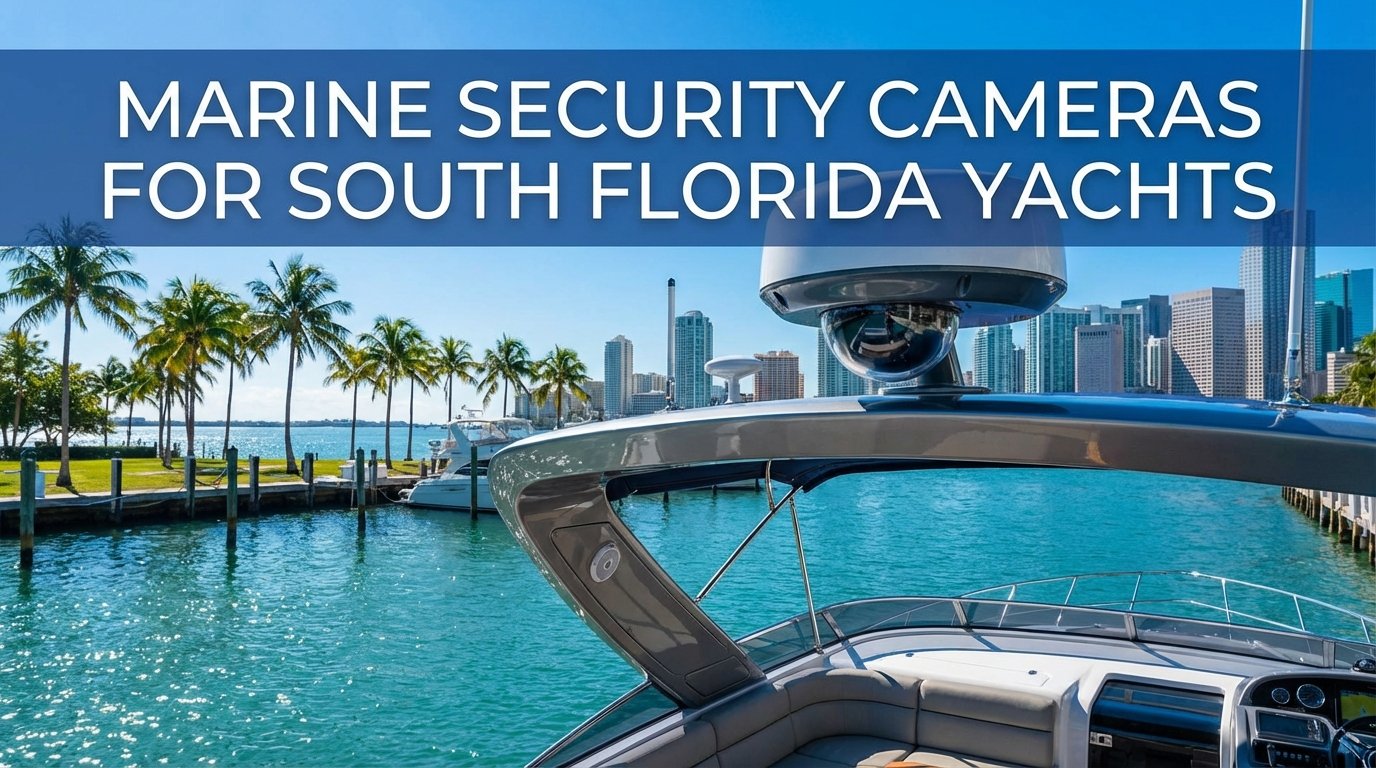
Choosing between Garmin and Raymarine represents one of the most significant decisions South Florida boat owners face when outfitting their vessels with marine electronics. Both manufacturers dominate the chartplotter and multifunction display (MFD) market, but they take distinctly different approaches to interface design, system architecture, and integration capabilities. This comparison cuts through marketing claims to examine real-world performance where it matters most—navigating the St. Lucie Inlet during incoming weather, managing offshore fishing electronics in the Gulf Stream, or plotting Bahamas crossings with reliable GPS accuracy.
Understanding the Key Differences

Garmin and Raymarine have evolved from simple GPS manufacturers into comprehensive marine electronics ecosystems. The fundamental distinction lies in their design philosophy: Garmin emphasizes intuitive operation with touchscreen interfaces optimized for quick access, while Raymarine focuses on sophisticated networking capabilities with their LightHouse operating system. Both companies maintain factory training programs for certified installers, ensuring proper NMEA 2000 network integration and system configuration.
The practical implications of these differences become apparent when you’re running offshore in challenging conditions. Garmin’s interface allows rapid waypoint marking and chart overlay switching with minimal menu diving. Raymarine counters with superior radar integration and FLIR thermal camera compatibility, features particularly valuable for navigating South Florida’s crowded waterways at night or in reduced visibility conditions common during summer afternoon storms.
Display Technology and User Interface

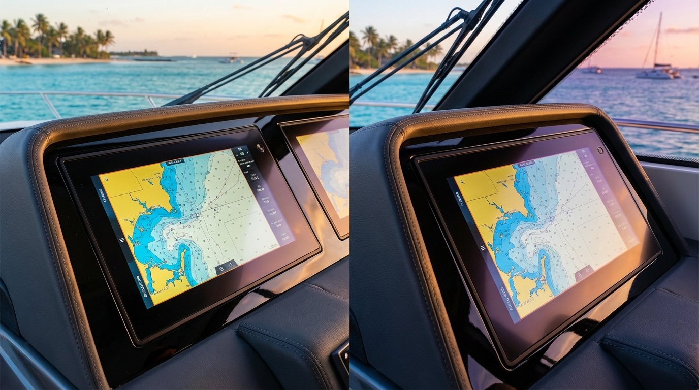
Garmin’s current flagship models utilize their latest IPS display technology with enhanced sunlight readability—crucial for South Florida’s intense UV conditions. The touchscreen response remains consistent even with wet hands or polarized sunglasses, addressing a common frustration for offshore anglers. Their interface employs a card-based system where users can customize home screens with frequently accessed functions like sonar, charts, and radar.
Raymarine’s Axiom and newer Axiom Pro series feature HydroTough nano-coating for saltwater corrosion resistance, extending display longevity in our harsh marine environment. Their LightHouse Sport operating system provides split-screen configurations that excel for tournament fishing applications where simultaneous monitoring of multiple sonar frequencies and chartplotter views proves essential. The learning curve runs slightly steeper than Garmin’s interface, but experienced users appreciate the customization depth.
Both manufacturers offer IP67-rated displays designed for permanent marine installation, but real-world durability varies. Saltwater exposure near the Roosevelt Bridge or during extended Gulf Stream crossings tests electronic components relentlessly. Proper installation with marine-grade connections and appropriate backing plates significantly impacts long-term reliability regardless of brand choice.
Chartography and Mapping Systems
The cartography landscape shifted dramatically when Garmin acquired Navionics in 2024, fundamentally altering the competitive dynamics. Garmin now offers both their proprietary BlueChart g3 Vision and Navionics+ mapping, providing comprehensive coverage of South Florida waters, the Bahamas, and Caribbean destinations. The Navionics integration includes community-sourced bathymetric data particularly valuable for flats fishing around Stuart and Port St. Lucie.
Raymarine maintains partnerships with LightHouse Charts and C-MAP, offering detailed coastal coverage with high-resolution satellite overlay imagery. Their chart rendering engine handles complex navigational data efficiently, displaying depth contours, navigation aids, and marina details without system lag. For serious offshore navigation and Bahamas crossings, many captains prefer C-MAP’s vector chart detail and route planning capabilities.
Chart updates represent an ongoing consideration. Garmin’s subscription model bundles both BlueChart and Navionics updates, simplifying the renewal process. Raymarine requires separate C-MAP subscriptions, potentially increasing long-term costs but providing flexibility for captains who prioritize specific chart features. Neither approach proves inherently superior—the decision depends on your preferred cruising grounds and mapping preferences.
Fishfinding and Sonar Technology
For the offshore fishing community running from Stuart to the Gulf Stream, sonar performance determines brand loyalty. Garmin’s LiveScope and Panoptix systems revolutionized forward-facing sonar technology, providing real-time fish tracking capability that transformed tournament fishing strategies. Their CHIRP sonar delivers exceptional target separation in deep water, identifying bait schools and structure with remarkable clarity.
Raymarine responded with RealVision 3D and CHIRP DownVision technology, offering competitive sonar imaging with particularly strong side-scanning performance. Their integration with Teledyne FLIR thermal cameras provides unique capabilities for locating floating debris, navigating inlets at night, and identifying marine mammals—safety considerations relevant to South Florida boaters running at night or in reduced visibility.
System integration proves critical for maximizing sonar investment. Both manufacturers utilize NMEA 2000 networking, but connector quality and backbone design significantly impact performance. A properly installed NMEA 2000 network with marine-grade connections, appropriate termination resistors, and clean power supply prevents the frustrating intermittent failures that plague poorly executed installations.
Radar and Collision Avoidance
Radar integration separates recreational electronics from professional-grade systems. Garmin’s GMR Fantom series utilizes solid-state radar technology with MotionScope Doppler highlighting moving targets in different colors—invaluable for tracking weather cells approaching from the Atlantic or identifying other vessels in congested shipping lanes near Port Everglades.
Raymarine’s Quantum 2 radar systems incorporate CHIRP pulse compression technology, delivering enhanced target resolution at close range while maintaining long-range detection capability. Their Bird Mode specifically filters radar returns to identify flocking seabirds, helping offshore fishermen locate feeding activity beyond visual range—a competitive advantage for charter captains and tournament anglers.
Both systems support collision avoidance features with AIS integration, displaying vessel traffic with heading and CPA (closest point of approach) calculations. This functionality proves essential when navigating South Florida’s busy coastal waters where commercial traffic, recreational vessels, and high-speed center consoles converge near major inlets.
Autopilot System Integration
Autopilot compatibility represents a crucial consideration for cruising vessels and serious offshore fishermen. Garmin’s Reactor hydraulic autopilot systems integrate seamlessly with their MFD lineup, providing advanced features like heading hold, route following, and wind-hold mode for drift fishing applications. Their Shadow Drive technology allows manual steering without disengaging the autopilot—a safety feature appreciated during emergency maneuvers.
Raymarine’s Evolution autopilot systems employ EV sensor technology for exceptionally responsive steering control, particularly beneficial in following seas and quartering wave conditions common when returning from Bahamas trips. The system learns your vessel’s handling characteristics, continuously refining steering algorithms for optimal performance across varying sea states and loading conditions.
Professional installation proves non-negotiable for autopilot systems. Improper rudder reference calibration, inadequate compass mounting, or incorrect gain settings create dangerous steering anomalies that jeopardize vessel safety. NMEA-certified technicians understand the critical configuration parameters that separate reliable autopilot operation from hazardous system failures.
Network Architecture and System Expansion
Modern marine electronics operate as integrated networks rather than standalone devices. Garmin’s NMEA 2000 implementation supports comprehensive system expansion, connecting engines, tanks, batteries, weather instruments, and entertainment systems through a unified backbone. Their network diagnostics tools help identify connectivity issues before they escalate into system failures.
Raymarine’s SeaTalkng network protocol—essentially NMEA 2000 with proprietary connectors—provides similar integration capabilities with particularly robust instrument compatibility. Their system architecture excels for larger yachts requiring multiple display stations and distributed processing across several network segments.
Network planning requires careful consideration of power budgets, data load capacity, and future expansion requirements. A professionally designed NMEA 2000 backbone accommodates adding instruments, cameras, and sensors without requiring complete system redesign—protecting your electronics investment as technology evolves and your needs change.
Reliability and South Florida Considerations
Saltwater corrosion, intense UV exposure, and hurricane season preparation define South Florida marine electronics challenges. Both Garmin and Raymarine manufacture marine-grade equipment designed for harsh conditions, but installation quality determines real-world longevity. Proper electrical connections with marine-grade tinned copper wire, correctly sized circuit protection, and clean power supplies prevent premature failures.
Hurricane preparation requires electronics protection protocols. Removable displays should be stored inland or in climate-controlled locations. Fixed installations need surge protection, proper grounding, and careful inspection of through-hull transducer installations that could compromise vessel integrity during storm surge events.
Emergency service availability matters when electronics fail during critical moments. Having access to NMEA-certified technicians familiar with both Garmin and Raymarine systems provides peace of mind when technical issues arise. Factory-trained installers maintain diagnostic equipment, software updates, and replacement component access that independent shops often lack.
Which System Suits Your Needs?
For offshore tournament fishermen prioritizing cutting-edge sonar technology and intuitive touchscreen operation, Garmin’s ecosystem delivers unmatched LiveScope capabilities and rapid interface response. The Navionics integration provides excellent chart coverage for South Florida and Bahamas destinations.
Cruising vessels requiring sophisticated radar integration, thermal camera capability, and advanced networking for larger yacht systems benefit from Raymarine’s architecture. Their autopilot systems particularly excel for displacement hulls and trawler-style vessels common among serious cruisers.
Budget considerations influence decisions, though focusing solely on initial purchase price overlooks installation costs and long-term service requirements. Professional installation by factory-trained technicians costs more upfront but prevents expensive troubleshooting and reinstallation expenses that plague budget installations.
Frequently Asked Questions
What’s better, Garmin or Raymarine?
Neither brand proves universally superior—the optimal choice depends on your specific boating applications. Garmin excels for offshore fishing with industry-leading LiveScope sonar and intuitive touchscreen interfaces. Raymarine advantages include sophisticated radar integration and advanced networking for larger yachts. Consider your primary use case: tournament fishing favors Garmin, while cruising and professional navigation lean toward Raymarine’s capabilities.
Is Garmin compatible with Raymarine?
Both manufacturers utilize NMEA 2000 and NMEA 0183 protocols for basic data sharing, allowing limited compatibility for engine data, GPS position, and depth information. However, proprietary features like sonar displays, radar integration, and advanced autopilot functions remain brand-specific. Mixed-brand installations require careful network planning by NMEA-certified technicians to ensure proper data flow and prevent communication conflicts.
What is the best GPS for a boat?
The best marine GPS system balances accurate positioning, reliable chartography, intuitive interface design, and robust construction for saltwater environments. Both Garmin and Raymarine GPS receivers provide sub-meter accuracy with WAAS correction. Chart quality proves equally important—Garmin’s Navionics integration offers exceptional detail for South Florida and Bahamas waters, while Raymarine’s C-MAP compatibility excels for offshore navigation. Professional installation with proper antenna mounting ensures optimal GPS performance.
Did Garmin buy out Navionics?
Yes, Garmin acquired Navionics in 2024, fundamentally changing the marine chartography landscape. This acquisition gives Garmin control of both their proprietary BlueChart system and Navionics’ community-sourced bathymetric database. Existing Navionics users can continue using their charts on compatible plotters, but future development focuses on Garmin’s integrated ecosystem. This consolidation provides Garmin customers access to superior chart coverage while potentially limiting options for competing manufacturers.
Making Your Decision
Selecting between Garmin and Raymarine requires honest assessment of your boating priorities, budget parameters, and technical comfort level. Test both systems at marine electronics retailers or during boat shows to evaluate interface preferences firsthand. Consider future expansion requirements—choosing a platform that accommodates adding cameras, instruments, and entertainment systems protects your investment as technology evolves.
Professional consultation with NMEA-certified marine electronics specialists provides invaluable guidance tailored to your specific vessel and applications. At Marine Electronics Installations, our factory-trained technicians maintain expertise across both Garmin and Raymarine platforms, ensuring objective recommendations based on your actual needs rather than inventory considerations.
Ready to upgrade your marine electronics with professional installation that ensures reliability and longevity? Contact our Stuart location at (772) 634-6055 or visit us at 7892 SW Jack James Dr, Stuart, FL, 34997. Our NMEA-certified team delivers expert consultation, precision installation, and ongoing support for South Florida boaters who demand excellence in their marine electronics systems.